Tres Rios Wetlands
First conceived of in 1994, Tres Rios Wetlands is a constructed wetlands project created late in the first decade of the 21st Century. The name Tres Rios (Three Rivers) was derived from the fact that three
rivers are in the immediate vicinity: the Salt River, the Gila River, and the Agua Fria River. The wetlands are located in Maricopa County Arizona a few miles south of the town
of Tolleson. The nearest major intersection is 91st Avenue and Broadway Road, about a mile to the north. Interstate 10 is just under 5 miles to the north of Tres Rios. The town of Goodyear is about 6 miles to the northwest.
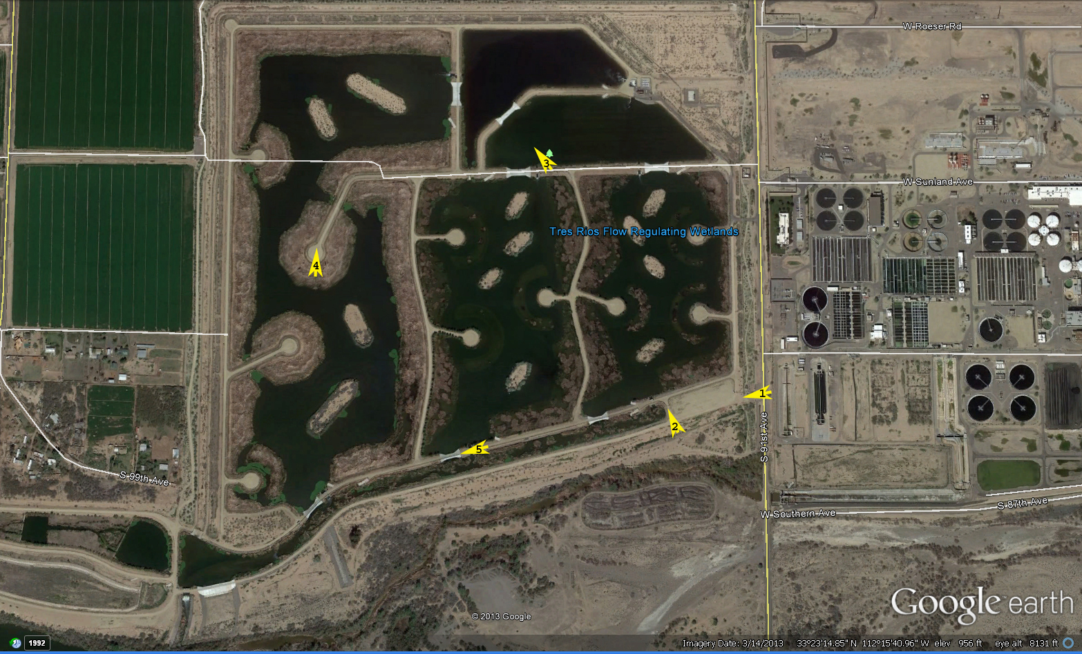
Below is an overview of Tres Rios.
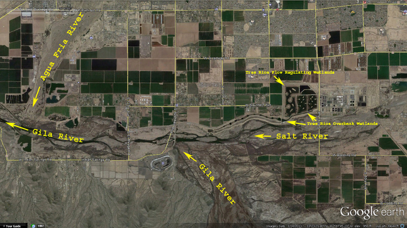
The Salt River and Gila River are both tributaries of the Gila River, thus terminating here.
Birding at Tres Rios
To legally park and visit Tres Rios you must obtain a free permit from the City of Phoenix. Below is a quote from the official webpage:
"*Birders and wildlife photographers interested in obtaining a Parking and Ingress Permit should send their postal mailing address to debbi.radford@phoenix.gov"
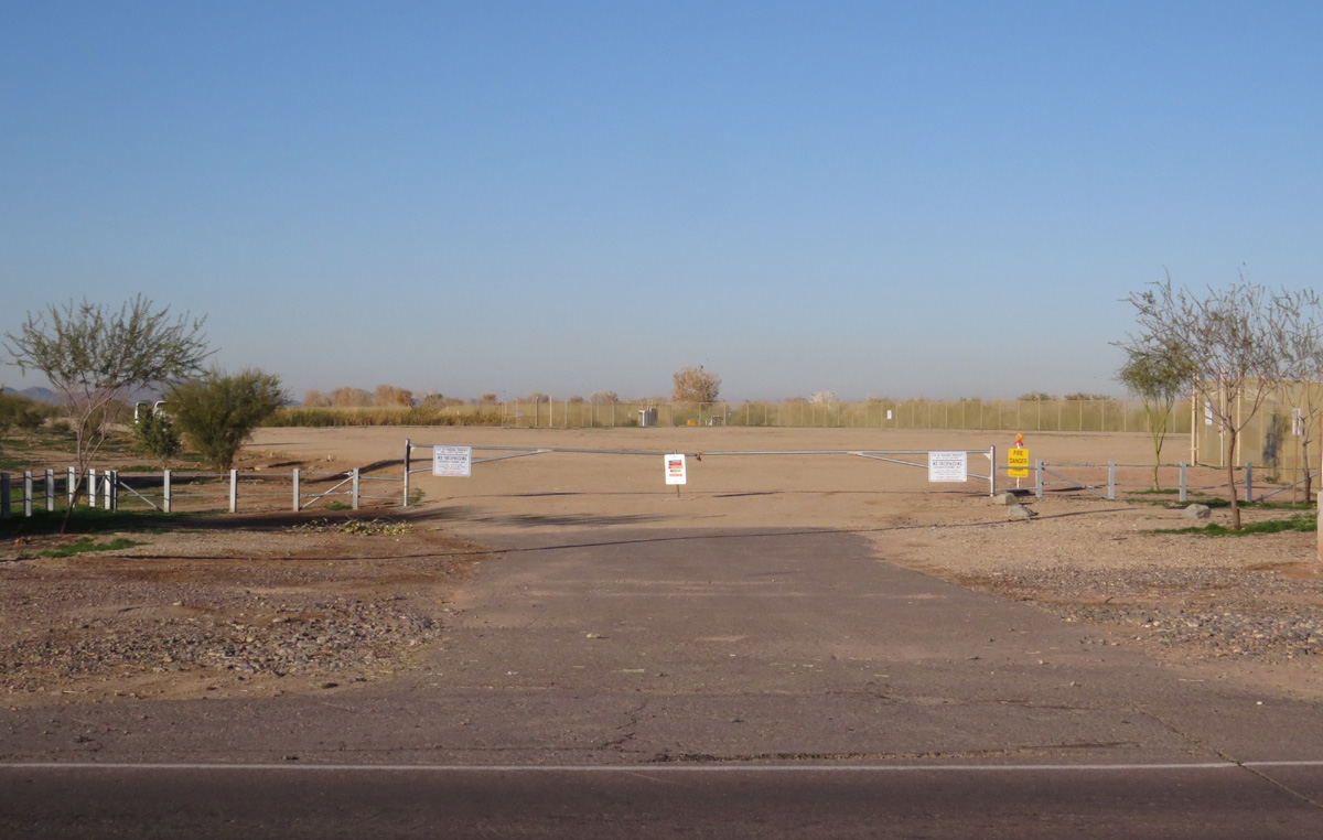
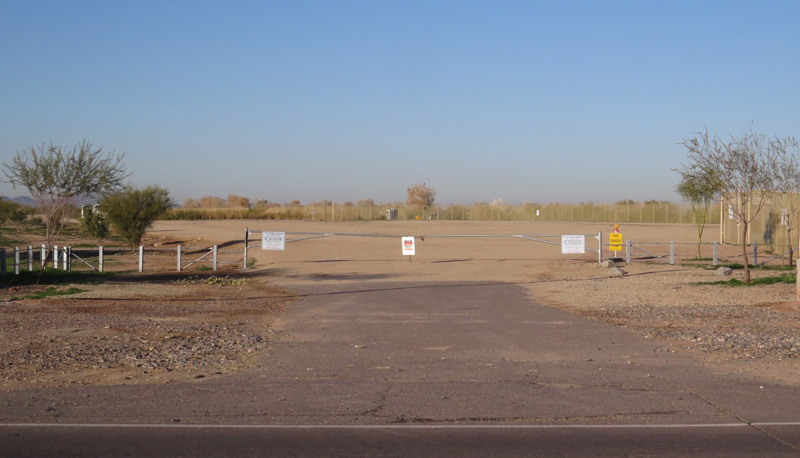
As of early 2014, permits are still required. The parking lot is a small dirt lot at the southeast corner of the Regulating Wetlands, on the west side of 91st Avenue. This lot just over a mile south
of Broadway Road. You can walk or bike past the entry gate, seen in a view below. Please click the image for a larger version.
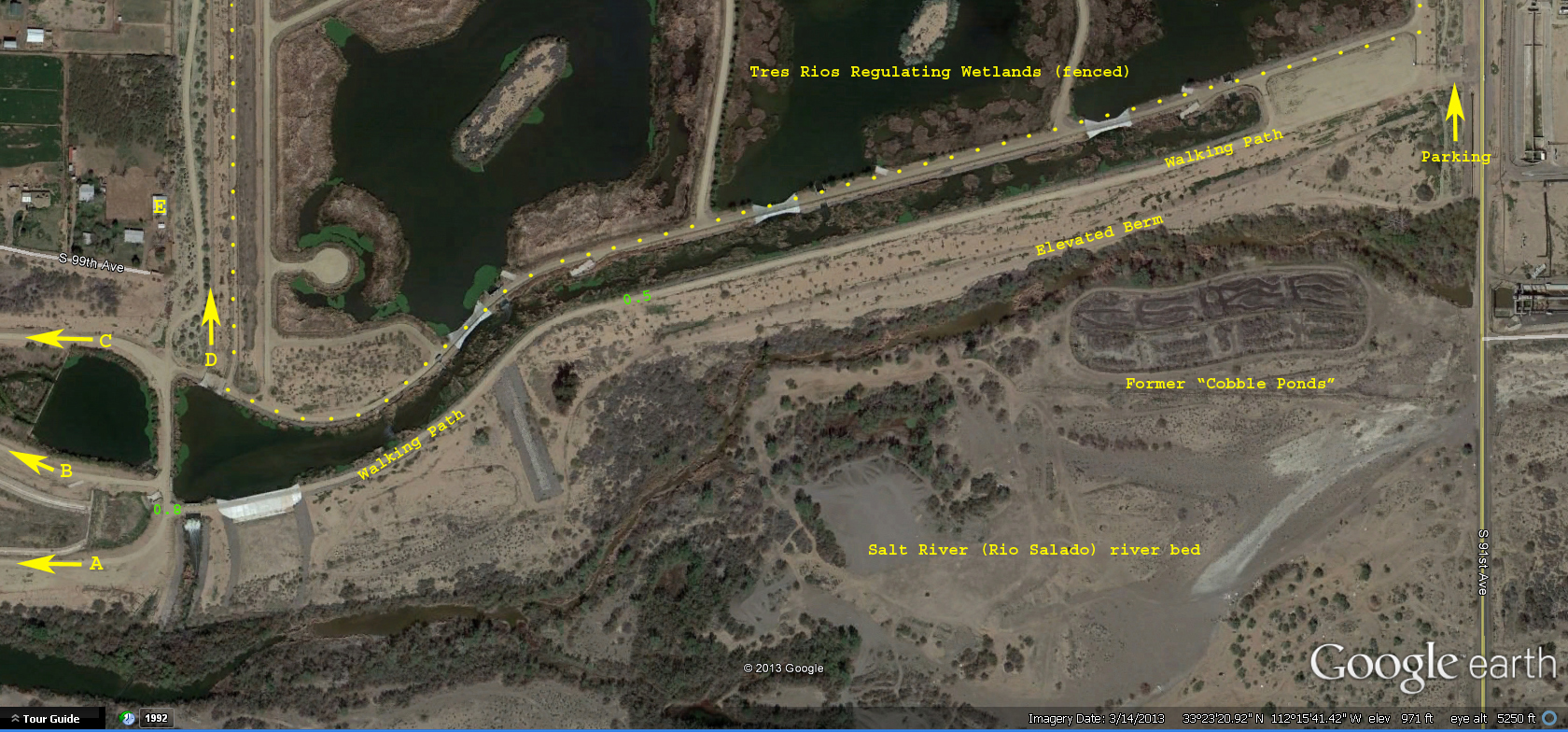
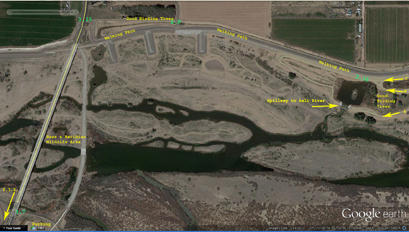
Once inside you are free to roam about for as long as you wish. The image below outlines the general area for the first 0.8 miles along the walking path. On the following photos, cumulative distances
from the parking area are shown in green  text. Please click the image for a larger version.

There are no mile markers at Tres Rios - I use the Google Earth path tool to measure distances on the computer. At the 0.8 mile point you can take one of four additional paths. A, B, & C
head further west, while D goes north along the western perimeter. The location "E" is a farm structure where I photographed some Peacock and Guineafowl in December 2013. Of the three
westbound paths, "B" is my preferred path for photography along the string of smaller ponds. For the record, I have returned to the 0.8 mile point via "A" & "C" on different walks...it's all
a matter of preference and which habitats one wishes to explore.
Caution is warranted in the Salt River riverbed and south of the general area.
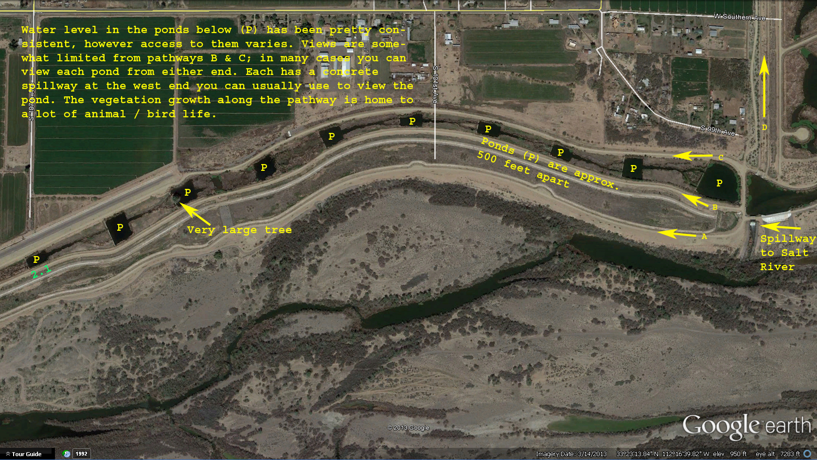
The image below shows the paths of A, B, & C. Please click the image for a larger version.

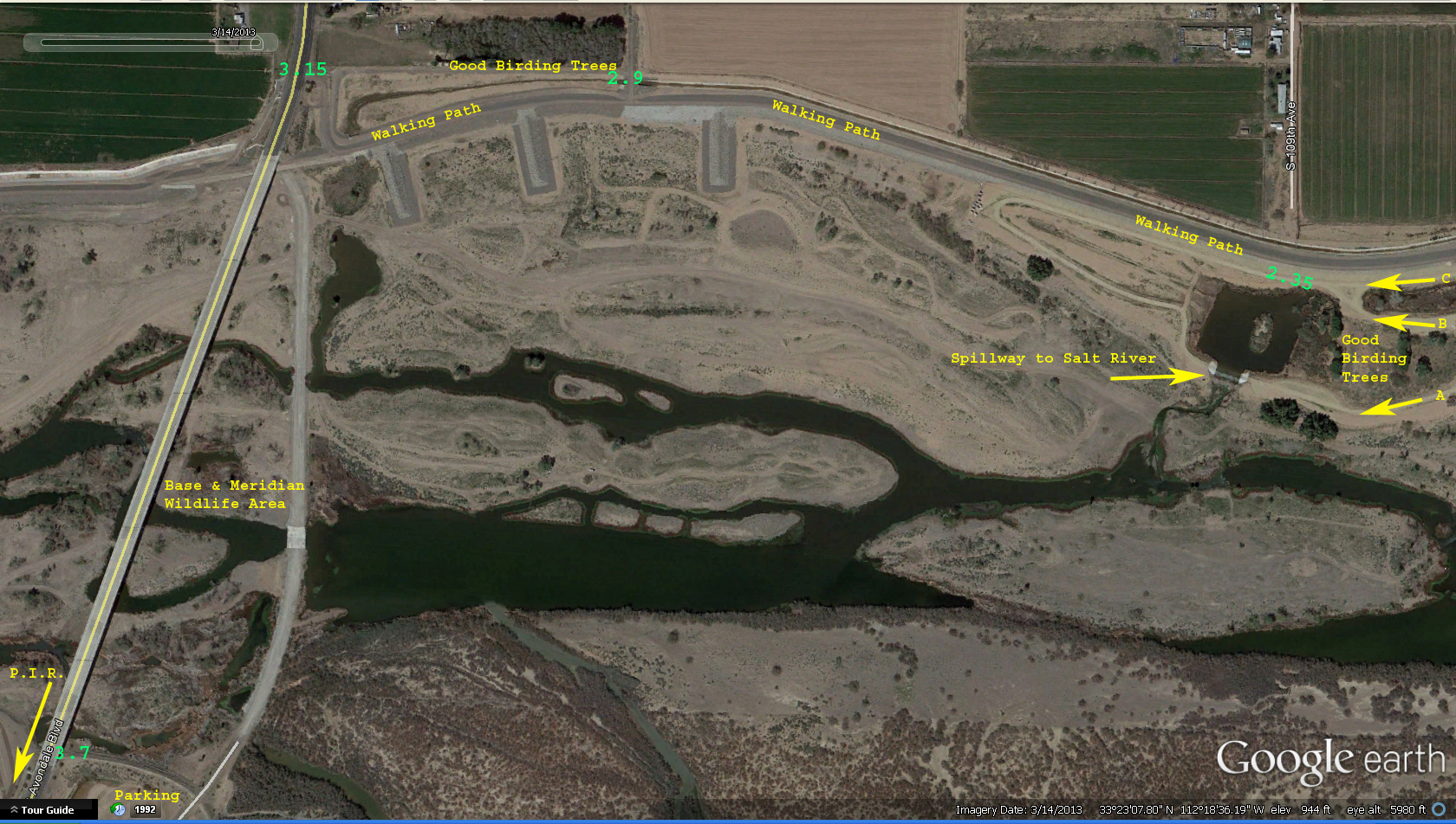
The image below shows the area west of the last ponds. If you've made it to the 2.35 mile spot, you're facing at least a 4.7 mile roundtrip walk. The area around here is quite birdy with many good
species being reported from here. From here you can return via any of the three paths...I've done all three.
If you want to stretch your legs a little more you can continue hiking to the Avondale Blvd / 115th Avenue bridge and have a walk across it. You may find some surprises in the
treetops as you make your way across. I once photographed two hummingbirds in a distant treetop...at that scale they appear really small. I also caught a Belted Kingfisher flying away from the bridge.
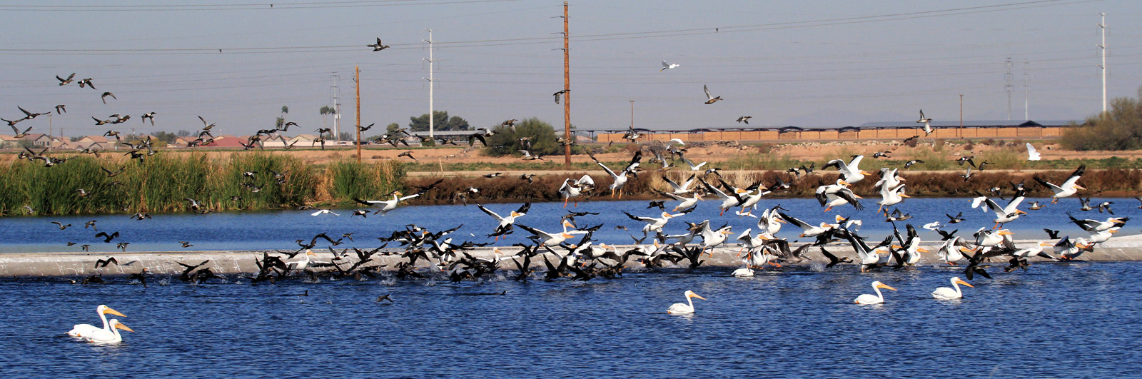
The typical herons and egrets are quite visible down in the riparian/marsh habitat, and if you like NASCAR, Phoenix International Raceway is on the south side of this bridge.
This bridge crosses over the Base & Meridian Wildlife Area, worthy of a visit in its own right. You can take the old
Avondale Blvd right-of-way and drop down into the wildlife area on foot, cross the bridge on foot, or if in your vehicle you can park beyond the south side of the bridge and walk back to the wildlife area. Please click the image for a larger version.
Below are "image maps" with hyperlinks to ground-level photographs I have taken of the areas. The photos taken inside the Flow Regulating Wetlands were obtained during
invitations to visit the area...rare opportunities not to be passed up.
The image below is a map of the Flow Regulating Wetlands and the entrance to the Overbank Wetlands. Please click the arrows to see photos.
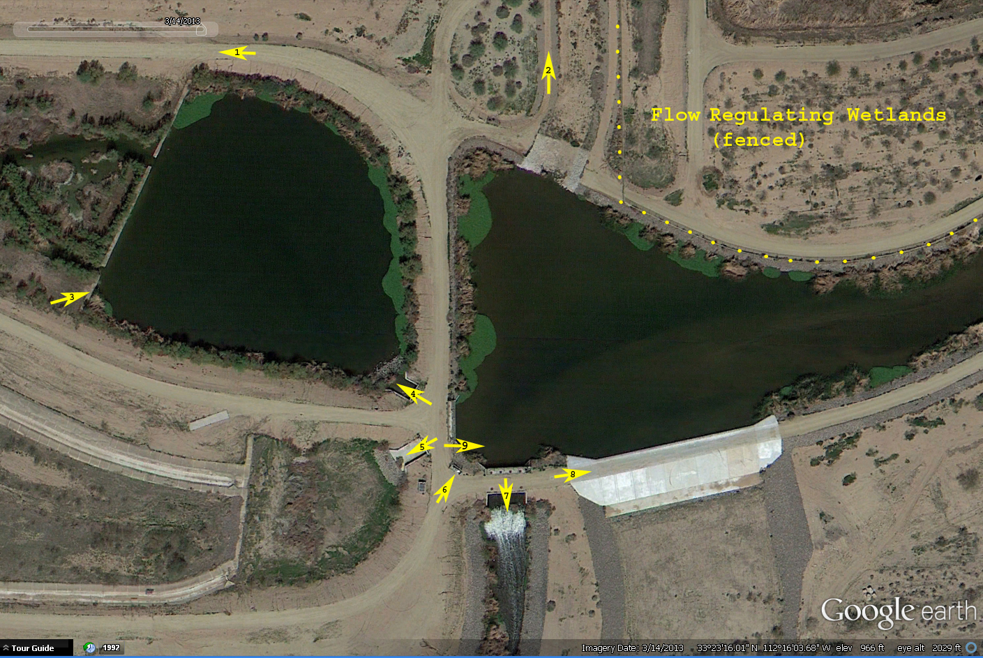
The image below is a map of the central "junction" area. Please click the arrows to see photos.
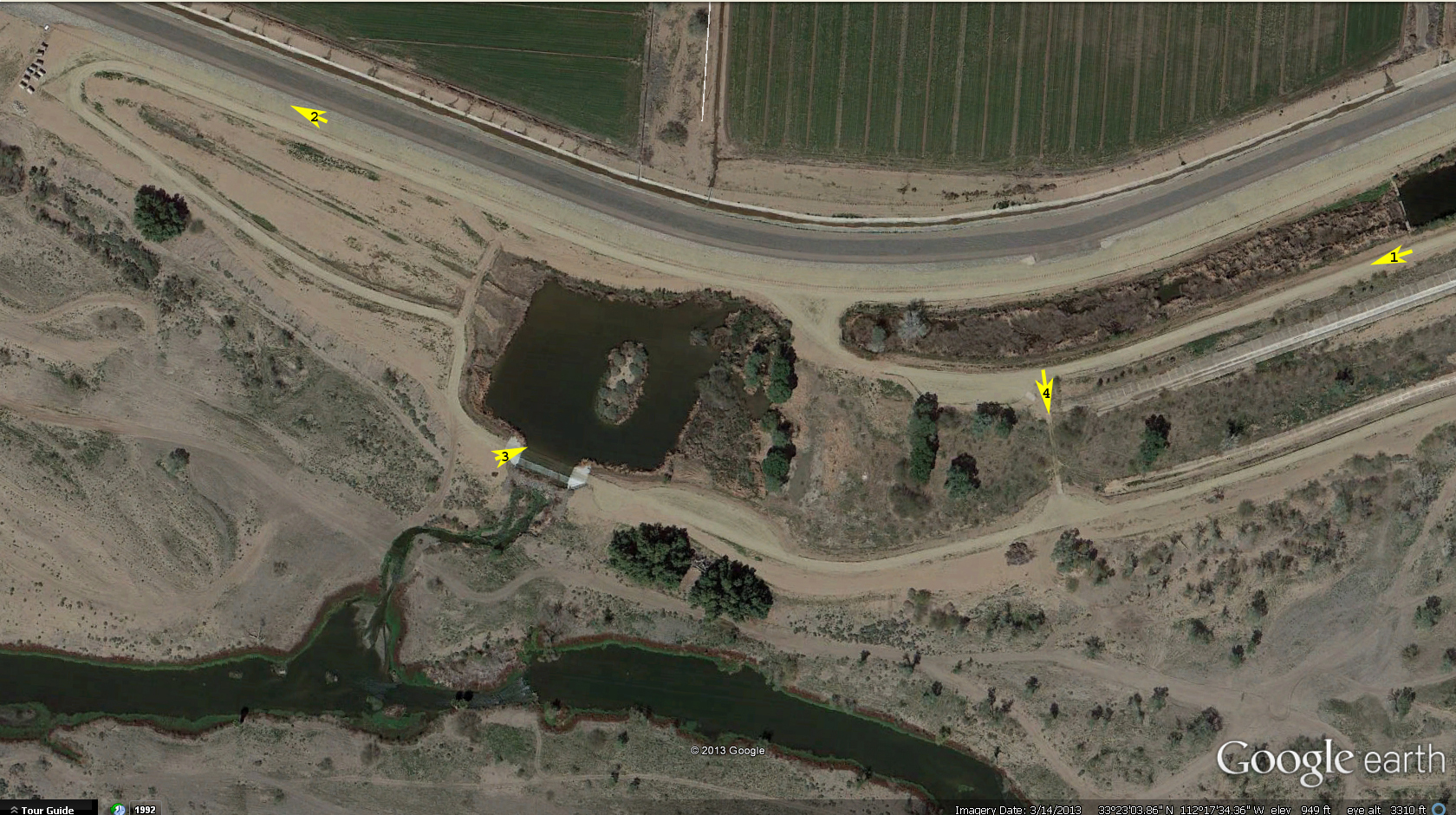
The image below is a map of the western end of Tres Rios Overbank Wetlands. Please click the arrows to see photos.
Tres Rios Official Website
Birder from Maricopa Tres Rios Overbank Wetlands Page